Araria district is one of the thirty-eight district of Bihar state, भारत, and Araria town is the administrative headquarters of this district. Araria district is a part of Purnia division. It has a prestigious past but enshrouded in the midst of uncertainties. Many stories have been widespread about it.

Ancient Ang king of India found in Ireland
In ancient times ruled by three important clans of Indian history Araria may be termed as a place of confluence of three entirely different cultures. The important tribe of Kiratas governed the northern side , while the eastern side was under the Pundras and area west of the river Kosi, at that time flowing somewhere near the present Araria, by Angas.
Angas are believed to be the earliest inhabitants of the district, mostly in the area west of the river Kosi and these are among the easternmost tribes as described in the Atharva-Samhita known to the Aryans. Pundras are said to be the descendents of Saint Vishwamitra. Whereas the Kiratas were among the few most important ruling clans of that time. It is said that Raja Virata of Mahabharata had married a Kiranti woman who was the sister of Raja Kichaka , King of Kiratas.

Araria district of Bihar was part of Ang kingdom
Manu regards the Kiratas as Kshatriyas. Mahadeva was associated with Kiratas and Bhima meets the Kiratas in the east of Mithila, अर्थात. the present Araria district. He is credited with having defeated seven of the Kirata rulers. Kiratas are described in the Kirata-Parva and Vana-Parva of Mahabharata and they were considered so powerful that even the Lord Shiva is said to have taken the form of a Kirata.
During the Mauryan period this area formed the part of the Mauryan Empire and according to Asokavadana the Emperor Asoka put to death many naked heretics of this area who had done despite to the Budhist religion. In later times the district formed the part of the empire of Imperial Guptas.
Angika is considered as oldest language of Hindi family. According to Pundit Rahul Sankritiyayan, the evidences of oldest form of written Hindi literatures are available in the Sarah’s Angika poetries of 800 ई..
The first poet of Hindi literature, Saraha, was also the first poet of the Angika language and literature. Saraha belongs to the 8th century, and is the first poet whose poetry is available in written form.
Myth says that though Bhagalpur today is a silent town, one can still feel the past resonating here. After all, it ranked among the six best Indian cities at one time.
Legend, buttressed by a little hard evidence, has it that today’s Bhagalpur was the Champavati of 5th century BC. It was a period when India’s earliest republics were evolving around the Gangetic plains. Anga was one of these sixteen Mahajanapadas (republics), and Champavati its capital. It was also referred to as Malini, Champapuri, Champa Malini and Kala Malini
Foundation of this kingdom is attributed to a prince named Anga. The Jaina Sutras refer to the city as adorned with gates, ramparts, palaces, parks and gardens. The city is depicted as a veritable paradise on earth, full of wealth, समृद्धि, joy and happiness. Champa traces its origin to the neolithic age when it was lucrative enough for the early settlers to inhabit the region. Ancient history enumerates no less than 25 kings who ruled Anga prior to the period of the Mahabharata. One such king was Lomapada, a contemporary and friend of Raja Dasratha (father of Lord Rama). The last among these kings was Karna, son of Kunti who fought the Great Mahabharata War as the commander-in-chief of the Kaurava army.
अंग, in the age of Buddha, was ruled by Brahmadatta, the last independent king who was killed by Bimbisara as a revenge for his father’s defeat. Bimbisara resided at Champa as Viceroy and his son Ajatsatru was so enamoured by the beauty of this vanquished city that he shifted his capital from Rajgir to Champa when he ascended the throne. बाद में, when Magadhans picked up a quarrel with the republic of Vaishali, they strengthened Patliputra and made it their new capital.
The great mound in the heart of Champanagar, surrounded by a moat, does not arouse curiosity in absence of lofty structures but excavations in and around the site have yielded traces of a fortified complex, besides an abundance of polished wares. Archaeologists have ascertained that the rampart was made of rammed earth, which was later (2nd century B.C) rivetted with burnt bricks. The mound referred to as Karngarh or the Palace of Raja Karan was overgrown with forest until Augustus Cleveland, the first Collector of the District, had it cleared. आज, this elevated structure houses a century old Sanskrit school besides the famous Manskamna Nath Mandir.
A mile from the Karngarh mound we find four elevations which are believed to have served as observation towers of the fort. In the north-east is Tilhakothi, the hillock which impressed the Collector Cleveland so much that he erected his residence here.
Ang Janpad situated on the bank of river Ganga or Bhagalpur has its own importance in history since ancient times.Ang region. It is believed that Champapur (also known as Champapuri, Champa, Champanagari) was the capital of Angadesh (भागलपुर शामिल
and Mongher).
Means Anga was a kingdom that flourished on the eastern Indian subcontinent in the 6th century BCE until taken over by Magadha in the same century. Counted among the “sixteen great nations” (solas Mahajanapadas) . Some refer that the Angas were grouped with people of ‘mixed origin’, generally in the later ages.
Based on Mahabharata evidence, the kingdom of the Angas roughly corresponded to the districts of Bhagalpur,Banka, Purnia, मुंगेर, कटिहार, Jumai, and Madhepur in Bihar and districts of Deoghar, Godda, and Sahebgang in Jharkhand; later extended to include parts of Bengal. The River Champa (modern Chandan) formed the boundaries between the Magadha in the west and Anga in the east. Anga was bounded by river Koshi on the north. According to the Mahabharata, Duryodhan had named Karna the King of Anga.
Sabhaparava of Mahabharata (II.44.9) mentions Anga and Vanga as forming one country. The Katha-Sarit-Sagara also attests that Vitankapur, a city of Anga was situated on the shores of the sea. Thus the boundaries of Anga may have extended to the sea in the east.
The capital of Anga was Champa (Camp?). According to Mahabharata and Harivansa, Champa was formerly known as Malini[ Champa was located on the right bank of river Ganges near its junction with river Champa. It was a very flourishing city and is referred to as one of six principal cities of ancient India .
The later kingdom of Champa (in present-day Vietnam) was thought to have originated from this east Indian Champa, although anthropological evidence indicates they are from Borneo on the other side Indochinese Peninsula.
Other important cities of Anga are said to be Assapura and Bhadrika.
Between the Vatsas and the realm of Anga, lived the Magadhas, who initially were comparatively a weak people. A great struggle went on between the Angas and its eastern neighbors. The Vidhura Pandita Jataka describes Rajgriha (the Magadhan Capital) as the city of Anga and Mahabharata also refers to a sacrifice performed by the king of Anga at Mount Vishnupada (at Gaya). This indicates that Anga had initially succeeded in annexing the Magadhas, and thus its borders extended to the kingdom of Matsya country.
This success of Angas did not last long. About the middle of 6th century BC, Bimbisara, the crown prince of Magadha had killed Brahmadatta, the last independent king of Anga and seized Champa. Bimbisara made it as his head-quarters and ruled over it as his father’s Viceroy. Thenceforth, Anga became an integral part of growing Magadha empire.
Ireland /Iwernia/ Angevin Empire
Ireland is an island to the northwest of continental To its east is the larger island of Great Britain, from which it is separated by the Irish sea.
The Iron age in Ireland is traditionally associated with people known as the celts. The Celts were commonly thought to have colonised Ireland in a series of invasions between the 8th and 1st centuries Bc. The Gales, the last wave of Celts, were said to have divided the island into five or more kingdoms after conquering it. The earliest written records of Ireland come from classical Greco -Roman geographers. Ptolemy in his Almagest refers to Ireland as Mikra Brettania (Lesser Britain), in contrast to the larger island, which he called Megale Brettania (ग्रेट ब्रिटेन). In his later work, भूगोल, Ptolemy refers to Ireland as Iwernia and to Great Britain as Albion.
Ireland continued as a patchwork of rival tribes but, beginning in the 7th century AD, a concept of national kingship gradually became articulated through the concept of a High king of Ireland. Medieval Irish literature portrays an almost unbroken sequence of High Kings stretching back thousands of years but modern historians believe the scheme was constructed in the 8th century to justify the status of powerful political groupings by projecting the origins of their rule into the remote past.
अवधि Angevin साम्राज्य is a modern term describing the collection of states once ruled by the Angevin Plantagenet dynasty.
The Plantagenets ruled over an area stretching from the Pyrenees to Ireland during the 12th and early 13th centuries, located north of Moorish Iberia. यह “साम्राज्य” extended over roughly half of medieval France, all of England, and some of Ireland.

This is Angevin / Ang(भारत) kingdom in Europe
The Angevin Empire : As far as historians know, there was no contemporary term for the region under Angevin control; however descriptions such as “our kingdom and everything subject to our rule whatever it may be” were used. The term Angevin Empire was coined by Kate norgate in her 1887 publication, England under the Angevin Kings. In France, the term Espace Plantagenêt (Plantagenet Area) is sometimes used to describe the fiefdoms the Plantagenets had acquired.
The adoption of the Angevin Empire label marked a re-evaluation of the times, considering that both English and French influence spread throughout the dominion in the half century during which the union lasted. The term Angevin itself is the adjective applied to the residents of Anjou and its historic capital, Angers; the Plantagenets were descended from Geoffrey, Count of Anjou, hence the term.
The papal bull Laudabiliter of Pope Adrian IV was decreed in 1155. It granted the Angevin king Henry II of England who ruled from Anjou in France, the title Dominus Hibernae. Laudabiliter enabled the king to invade Ireland, in order to bring the country into the European sphere.
In fact the Houses of Anjou or Houses of Angevin or the Angevin dynasties are three historical and separate noble houses, whose powerbase originated in the French province of Anjou.
Angdeshi or Andes ?
Andecavi (यह भी Andicavi) or Andegavi, also Andes in Julius Caesar’s Bellum Gallicum, were a people of ancient and medieval Aremorica. They gave their name to the Comte’ Anjou, called Andegavia in medieval latin and the origin of the name Angevin.
Andecavi is a celtic tribe lived in Armorica. Their territory was on the northern bank of river Loire.

Angeln map in France
Comte’ Anjou or ‘Kamta’ of Coochbihar?
Andecavi (यह भी Andicavi) or Andegavi tribe gave their name to the Comte’ Anjou, called Andegavia in medieval latin and the origin of the name Angevin in Europe. While in India It is believed that the ancient Koch kingdom of Cooch Behar was known as ‘Kamta’ and the kings called themselves ‘Kamteshwar’ or the lords of Kamta.
Archeological records indicate that the medieval history of Cooch Behar dates back to the Pala-Senas period in 11-12th century A.D. Sculptures, coins, temples and mosques in the area proves this fact and the remains found at Rajpat, Dinhata, exposes the ancient capital of Kamtapur ruled by the Khen kings. It is believed that deep within the mound at Rajpat, which is presently protected by the Archeological Survey of India, lays the palaces of Kamtapur and the Kamteswari Temple.
The Narayan dynasty was formed on the ruins of the Kingdom of Kamrup, established by the first Maharaja, Chandan Narayan in 1510 ईसवी; he was of Koch and Mech descent. उसके बाद, his successor to the throne, Maharaja Vishnu Narayan and his son Maharaja Nara Narayan expanded the empire by conquering vast areas of land in the region.

Coochbihar in India or irish Cúige Uladh ?
The Narayan dynasty ruled Cooch Behar from the 16th century and maintained its rule even after the Battle of Plassey in 1757 – the battle between Siraj-ud-daula and the East India Company. Near about the 18th century, following the invasion by the king of Bhutan, the kingdom of Cooch Behar came under the protection of the British Empire. After independence, it was ceded to the Government of India, and was finally merged with the state of West Bengal. The royal families of Cooch Behar were heavily influenced by British culture, tradition and education and enjoyed great privileges from Queen Victoria. This trend was made popular, especially, by Maharaja Nripendra Bahadur Narayan who ruled Cooch Behar from 1863 - 1911; two of his daughters married Europeans and all his children was educated in England. The family belonged to the Rajbanshi and was very cultured, modern and broad-minded in their views; they actively promoted social reforms and Indian literature in India and the European countries.
The legacy of the Narayan Dynasty can be found in the royal palaces, buildings and temples built by the successive kings in Cooch Behar; उदाहरण के लिए, the Rajbari Palace, and other heritage buildings were erected during the rule of these kings.
Cocani, Gangani ,Deceangli (Decangi) and Causi tribe
The Gangani and Deceangli were warlike Celtic tribes that were situated in the extreme north of modern Wales, जहां देर आयरन आयु आदिवासी सीमाओं ब्रिटेन के बाकी की तुलना में अधिक अनिश्चित भी थे. शायद देर से तीसरी लहर सेल्टिक आमद (अपने पड़ोसियों के विपरीत), Gangani के राज्यक्षेत्र Lleyn प्रायद्वीप पर था, है जबकि Deceangli क्षेत्र उत्तर - पश्चिम और उत्तर - पूर्व Clwyd और उत्तरी Gwynedd शामिल.
लिंक to Causi tribe
उत्तरार्द्ध जनजाति पहाड़ी किलों के आसपास मुख्य रूप से ध्यान केंद्रित किया गया था, उनमें से एक स्ट्रिंग अपने आदिवासी क्षेत्र के पूर्वी भाग में Clwydian रेंज की लंबाई के साथ बिंदीदार के साथ, Moel से Hiraddug और नदी के पूर्वी तट के साथ निम्नलिखित. एक अन्य संभावित किले Dinas Dinorwig पर था Menai जलडमरू अनदेखी. Deceangli भी Canovium में एक प्रमुख आदिवासी केंद्र के पास (Gwynedd में आधुनिक Caerhun). यह एक आदिवासी राजधानी में रोम के लोगों द्वारा कभी नहीं विकसित किया गया था.

you can see Gangani, कारण (बिहार में नदी) and cocani tribes in map
जनजातियों के लिए आयरलैंड और ब्रिटेन के बीच विभाजित किया गया है दिखाई देते हैं. हालांकि बाद में वे Gangani और Deceangli बुलाया गया, आयरिश सागर के पार सीधे उनके चचेरे भाई Concani या Gangani थे (इस क्षेत्र में जो बाद में Leinster की भाग का गठन). ऐसा लगता है कि वे पहली बार आयरलैंड में बसे हो सकता है और फिर हाल ही में प्रथम शताब्दी ई.पू. से पश्चिमी ब्रिटेन के लिए चले गए, 'नाम Lleyn के रूप में’ प्रायद्वीप को Laigin से प्राप्त किया जा रहा है, Leinster के पुराने फार्म. There is ancient tribe name “ Causi” too. River Causi flows in Bihar.
Link to Gangani tribe
Angers is the main city in the Maine –et- Loire department in western France about 300 कि. (190 मेरे) south-west of Paris. Angers is located in the French region known by its pre-revolutionary, provincial name, Anjou, and its inhabitants are called Angevins.

Ancient caaatle of Anger (Ang?) in France
Angers proper has a population of 157,000 निवासियों, while c. 283,000 live in its metropolitan area. The city traces its roots to early Roman times. It occupies both banks of the Maine, which is spanned by six bridges. The district along the river has flourishing nurseries and market gardens. It is known for its fresh produce and cut flowers.
he earliest known inhabitants were the Andecavi, a Gallic tribe that was overrun by the Romans. शहर, while under Roman rule, was called Juliomagus.
The Council of Angers was held here in 453.
The city suffered severely from the invasions of the vikings in 845 and succeeding years.
Angers was once the capital of the historic province of Anjou.. Beginning in the 9th century, the region was controlled by a powerful family of feudal lords. It is the cradle of the House of Plantagenet who ruled England from the twelfth century and gave name to the Angevin Kings of England..
An enormous castle, the Chateau d’ Angersd, was built during the minority of Louis IX (“Saint Louis”) in the early part of the 13th century. में 1352, John II le Bon, gave the château to his son, Louis I. Married to the daughter of the wealthy Duke of Brittany, Louis I had the château modified, में और 1373 commissioned the famous Apocalypse Tapestry from the painter Hennequin de Bruges and the Parisian tapestry-weaver Nicolas Bataille.
The Iron Age in Ireland began about 600 ई.पू.. The period between the start of the Iron Age and the historic period (ई. 431) saw the gradual infiltration of small groups of Celtic speaking people into Ireland, with items of the continental Celtic La tene style being found in at least the northern part of the island by about 300 ई.पू..
Within these kingdoms a rich culture flourished. The society of these kingdoms was dominated by an upper class consisting of aristocratic warriors and learned people, which possibly included Druids.
The Romans referred to Ireland as Hibernia.Relationship between Rome and the dynasties and peoples of Hibernia remains unclear.
Booklink
“The Story of Ireland”
एक और सबूत
Champanagari Angadesh की राजधानी थी (भागलपुर शामिल
and Mongher – presently known as Munger).

Look at district of ,katihar ,मुंगेर,Bhagalpur
बिहार जिला मुंगेर :मुंगेर शहर मुंगेर जिले का मुख्यालय है, भारत के बिहार राज्य में. ऐतिहासिक दृष्टि से, मुंगेर आग्नेयास्त्रों और तलवार जैसे लोहे के लेख के निर्माण के लिए जाना जाता है. मुंगेर में प्रमुख संस्थानों में से एक बिहार योग विद्यालय है. यह एक योग के लिए दुनिया में सबसे महत्वपूर्ण शिक्षा केंद्र के एक है और दुनिया भर में सभी लोगों द्वारा frequented. मुंगेर गंगा के तट पर स्थित है और इसके सुखद स्नान घाटों के लिए जाना जाता है.

County map of Ireland shaws Monaghan county
Irish county Monaghan is a county in Ireland. Monaghan county council is the local authority responsible for the county. यह अलस्टर के प्रांत में स्थित है और सीमा क्षेत्र का हिस्सा है. यह मोनाघन के शहर के नाम पर रखा गया था. काउंटी की आबादी है 60,495 के अनुसार 2011 जनगणना.
__________________________________________________________
अनुसंधान के अंत में…. (Angdeshi or Angrej? )
To understand Ireland we have to Understand river Koshi from its Origin to Bihar where it meets river Ganges.
इससे लिंक करें कोशी नदी
इससे लिंक करें नदी Kaushiki
इससे लिंक करें Balkhand रामायण की
Believe above words. It is not Mythology only.It is true story of our acesors.
Above facts connects “Comte” rulers of Anjou who ruled including south Ireland and Our “Kamta” या ” Kamteshwar” rulers of Coochbihar. It is hard reality now that Andecavi or Andes Belgic tribe of Aremorica were Comte rulers. It is hard reality now that Causi tribe of Iraland and river Koshi has relation.
But now we know that these Celtic tribes originally migrated from DevBhumi and reached Denube in form of Gemanic tribes. They reached Denube Bank and named “Deutsch land”. NOw we know that Agni ,Yama and Ikshvakuvashis were common in Devbhumi and DEutschland. Now let us check similarities between Ireland and Devbhumi.
Kamet Mountain of Garhwal
Kamet is the second highest Mountain in the Garhwal region of India, after Nanda Devi. It lies in the Chamoli District of Uttarakhand, close to the border with Tibet. It is the third highest mountain in Indian-controlled territory, although it ranks lower if counting mountains inside Indian-claimed territory in Pakistan, and it is the 29th highest in the world. Kamet is most properly considered part of (and the highest summit in) the Zaskar (or Zanskar) Range, which lies north of the main chain of the Himalayas, between the Suru River and the upper Karnali River. In appearance it resembles a giant pyramid topped by a flat summit area with two peaks.
इससे लिंक करें Kamet moumtain
Means Particular ancient tribes of Devbhumi carrying responsebilities of defending particulart mountain ranges? Are the Mountain names of Devbhumi are clue to history? was that ancient tradtion of defending Bharatvarsha?
अब हम जानते हैं कि “दोनों produ “(Ibi परित्यक्त बालक के रूप में भी जाना जाता है) is a Himalyan mountain peak situated in the Chamol district of Uttarakhand state in India, 2 कि. (1.2 मेरे) Kamet के पूर्वोत्तर. चमोली जिले के उत्तरी सीमा पर स्थित है, जहां भारत तिब्बत से मिलता है.
You see That way our Kamte rulers of Coohbihar and Irish Comte Rulers connected. Kamet Mountains connects both. Now read history of our Kamte rulers of Coochbihar. You can understand history better.
Now we Shall check the facts How Nainital (or Nandadi ?) connected with “Ui Neil” आयरलैंड के.
Neil / Nigel / Or Negi ?
Neil is a masculine Given name of Gaelic origin. The name is an Anglisidation of the Gaelic Niall which is of disputed derivation. The Gaelic name may be derived from words meaning “बादल”, “passionate”, या “champion”. As a surname, Neil is traced back to Niall of the Nine Hostages who was an Irish king and eponymous ancestor of the Ui Neill and MacNeil and kindred. Most authorities cite the meaning of Neil in the context of a surname as meaning champion.
इससे लिंक करें Neil
नैनीताल
Nainital is a popular hill station in the Indian state of Uttarakhand and headquarters of Nainital District in the Kumaon Foothills of the outer Himalayas. Situated at an altitude of 2,084 मीटर (6,837 फुट) above Sea level, Nainital is set in a valley containing a pear-shaped lake, approximately two miles in circumference, and surrounded by mountains, of which the highest are Naina (2,615 मीटर (8,579 फुट)) on the north, Deopatha (2,438 मीटर (7,999 फुट)) on the west, and Ayarpatha (2,278 मीटर (7,474 फुट)) on the south. From the tops of the higher peaks, “magnificent views can be obtained of the vast plain to the south, or of the mass of tangled ridges lying north, bounded by the great snowy range which forms the central axis.
It is believed that Nainital figures in some ancient myths of India. In the Manas Khand of the Skand Puranas, Nainital Lake is called Tri-Rishi-Sarovar, hinting at the story of three sages (orRishis), Atri, Pulastya and Pulaha, कौन, upon finding no water in Nainital, dug a large hole at the location of the present day lake (sarovar = lake) and filled it with water from the holy lake Mansarovar in Tibet. According to lore, a dip in Naini Lake, “the lesser Manasarovar,” earns merit equal to a dip in the great lake.
It is also believed that The Naini Lake is one of the 64 Shakti Peeths, or religious sites where parts of the charred body of Sati (पार्वती) fell on earth while being carried by Lord Shiva. The spot where Sati’s eyes (or Nain) fell, came to be called Nain-tal or lake of the eye. The goddess Shakti is worshipped at the Naina Devi Temple on the north shore of the present day lake.
इससे लिंक करें नैनीताल
Ayarpata / Ayar tree
Seven Hills encircle Nainital –one of the Hll name is Ayarpata.
‘Ayarpata’ derived its name is from the Ayar tree.
लिंक -1 for More detail
लिंक -2 और अधिक के लिए Detail
इससे लिंक करें Ayar tree
Kilmora is final Clue
Yes Kilmora flowers of Katyuri valley is final Clue to ancient History. It conncects Katarmal sun temple and Britain. During olden days people living near Almora plug Kilmora plant for washing the utensils of “Katarmal sun Temple”.
कैसे?
अल्मोड़ा / Kilmora
Almora is located at 29.62°N 79.67°E . It has an average elevation of 1,651 मीटर (5,417 पैर). यह एक रिज पर हिमालय रेंज के कुमाऊं हिल्स के दक्षिणी किनारे पर स्थित है. एक घोड़े की काठी के आकार पहाड़ी की आकृति में, यह चीड़ और देवदार के पेड़ के घने जंगलों से घिरा हुआ है. Flowing alongside the city are rivers of Koshi, (Kaushiki), और Suyal (Salmale).

Kilmora flowers conncts Almora and Kilmora county of Ireland
The snow capped Himalayas can be seen in the background.Almora got its name from “Kilmora” a short plant found nearby region. during olden days people living near Almora plug Kilmora plant for washing the utensils of “Katarmal Temple”. Soon the people bringing Kilmora were called Kilmori and later “Almori”. So the place from where Almori comes came to be known as “Almora”.
और अधिक के लिए लिंक तथ्यों
दूसरा के लिए लिंक Fats
इससे लिंक करें Kilmora Fruit
Kilmora Irish county
Kilmore (आयरिश: An Chill Mhór, अर्थ “Great Church”) is a Civil and ecclesiastical Parish of County Cavan in the Repbulic of Ireland. यह स्थित है के बारे में 3.5 मील की दूरी पर (5.6 कि.) south-west of the County Town of Cavan.
Kilmore gave its name to an Irish civil Parish and was located mainly in the Barony of Upper Loughtee, but partly in the barony of Clanmahon, all in County Cavan in the Province of Ulster.
इससे लिंक करें Kilmora county
At last I want to say that “Burhaditya” was name of Deity of Katarmal sun temple….!
Link to Teldiha Tarapur मंदिर
इससे लिंक करें Tuatha De Danann आयरलैंड के
———————————————–
At the end of the redearch
Angles /Anegundi / Angrej
इससे लिंक करें Angles that says history of Anegundi..town of ancient kingdom of Kishkindha…
Now you read about Angevin kingdom and Angelcynn origin.
इससे लिंक करें Angevin kingdom यूरोप के.
इससे लिंक करें Angelcynn मूल
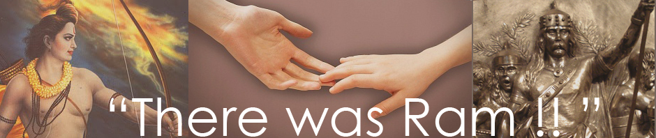
वहाँ राम
Aravidu dynasty..that build Tirupati temple
Now we know that name Elizabeth has roots in Aliya..Beti. That Aliya term has roots in Aravidu dynasty..who build Tirupati temple..! Aliya Ramaray was King of this dynasty.
इससे लिंक करें Aravidu dynasty will say you history of Ireland..
MEANS WALES HAS ROOTS IN WARANGALA KINGDOM WHILE IRELAND HAS ROOTS IN ARAVIDU DYNASTY? NOW GO DEEPER INTO UNITED KINGDOM AND SEARCH THAT BRITAIN CARRY HISTORY OF WHICH ANCIENT INDIAN KINGDOM ? IDOUBT THAT RAJ BARAH (12 ANCIENT INDIAN KINGDOM EXIS THERE.RAJBAR…RAJBARA)
करने के लिए कड़ी ARAVIDU DYNASTY
इससे लिंक करें Aravidu Dynasty कर्नाटक के
बुक करने के लिए लिंक Arawidu Dynasty will say you further story..


